5 things about Putrajaya you might not know
- 1.3KShares
- Facebook1.2K
- Twitter13
- LinkedIn22
- Email15
- WhatsApp49
PS: If you’d like more stories like this, please subscribe to our HARI INI DALAM SEJARAH Facebook group 🙂
The 1st of February is Federal Territory day! KL always gets the glory on Federal Territory day, notice how it’s Federal Territory and not Federal Territories? Sure, it’s supposed to commemorate the day KL was transferred to the federal government, but there’s ANOTHER city we regularly neglect. Yes, it’s in the title. PUTRAJAYA!
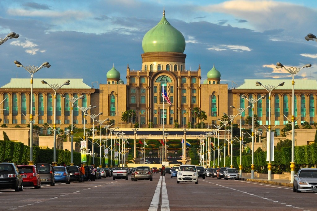
The pearl of Tun M’s Malaysia, filled with glistening buildings across a picturesque lake. Meticulous planning went into every detail, from the distance between neighborhoods and the main avenue (inspired by the Champs-Élysées in Paris!) to the shapes and sizes of walkways. And of course, buildings so big they make KL’s offices look cramped.
Well it’s been exactly 18 years since the first staff of the Prime Minister’s office moved into Putrajaya. So let’s take a look at how it all started, how things turned out and take a peek at what the future might hold for the national capital.
1. Putrajaya was originally land gifted to Ang Moh soldiers who used it to make rubber trees bonk
This is the story of Air Hitam, a bleak piece of backwater (blackwater, heh). After the First World War aka The Great War, the British gave the land to some soldiers as recognition for their services. The soldiers created an estate and company in 1921, which they named Perang Besar (translated to ‘Great War’, you know, since that’s how they got the land) with the aim of breeding some of the newest and most hi-tech trees.
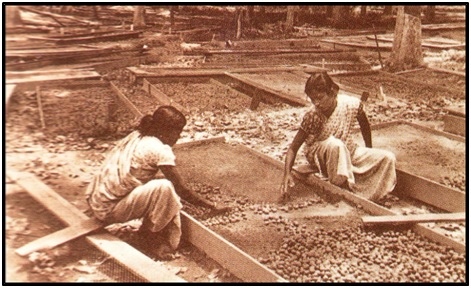
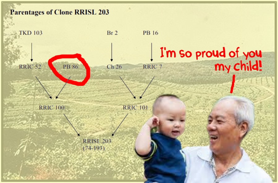
They dabbled with seed selection and budgrafting (a way to get the trees to reproduce while selecting for desired traits) until they got the tree they wanted, which they named PB 86 (Perang Besar 86). PB 86 was so successful that clones of the parent PB 86 plant continued to be used up til the 80s. Many of today’s modern rubber trees can actually trace their genetic roots to this specific PB 86 clone!
It’s no secret that rubber was vital to Malayia’s economy, with the country supplying a whopping half of the world’s rubber by 1930. And there’s a sort of poetic justice to be seen here, the estate which originally seeded the foundations of our economic growth would later become the literal foundations of the nation’s capital. In fact, rubber last year has surpassed palm oil in contribution to the nation’s economy. (Geddit, cos rubber represented our initial monetary capital and Putrajaya, the nation’s new capital, and its buildings are built on Perang Besar? Don’t you love it when jokes are explained???)
2. Putrajaya was almost built in… Janda Baik, Pahang!?
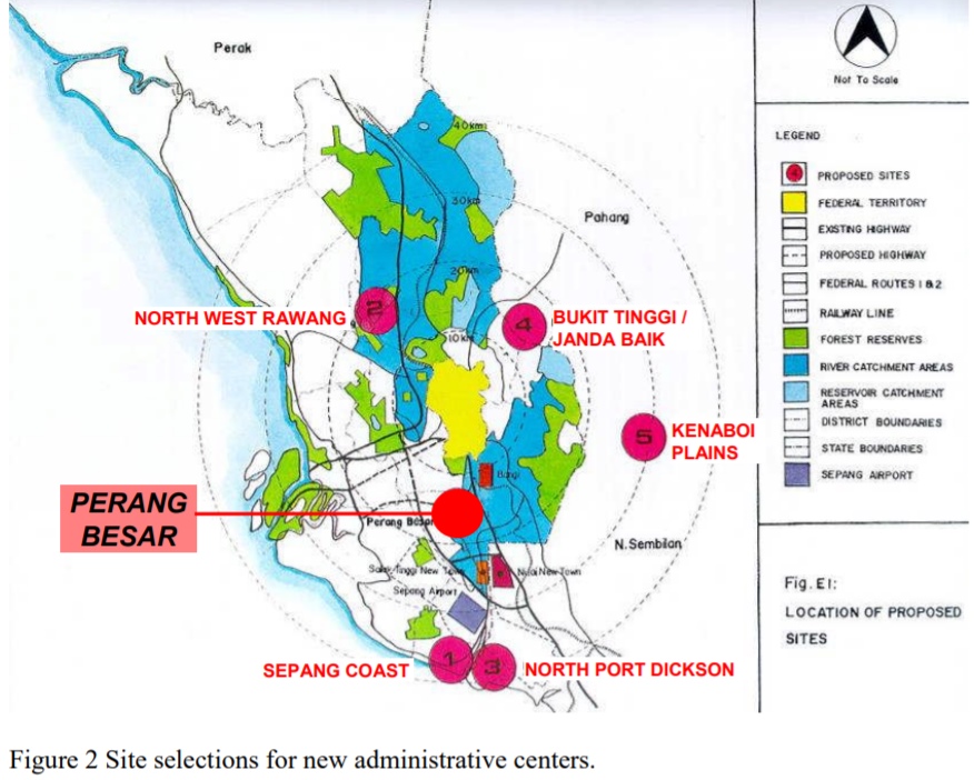
As the story goes, KL in the 90s was getting congested and the federal government decided it would be more efficient to move elsewhere to avoid the jam. The government by 1993 had shortlisted two possible sites for its new capital, Perang Besar in Selangor and Janda Baik in Pahang.
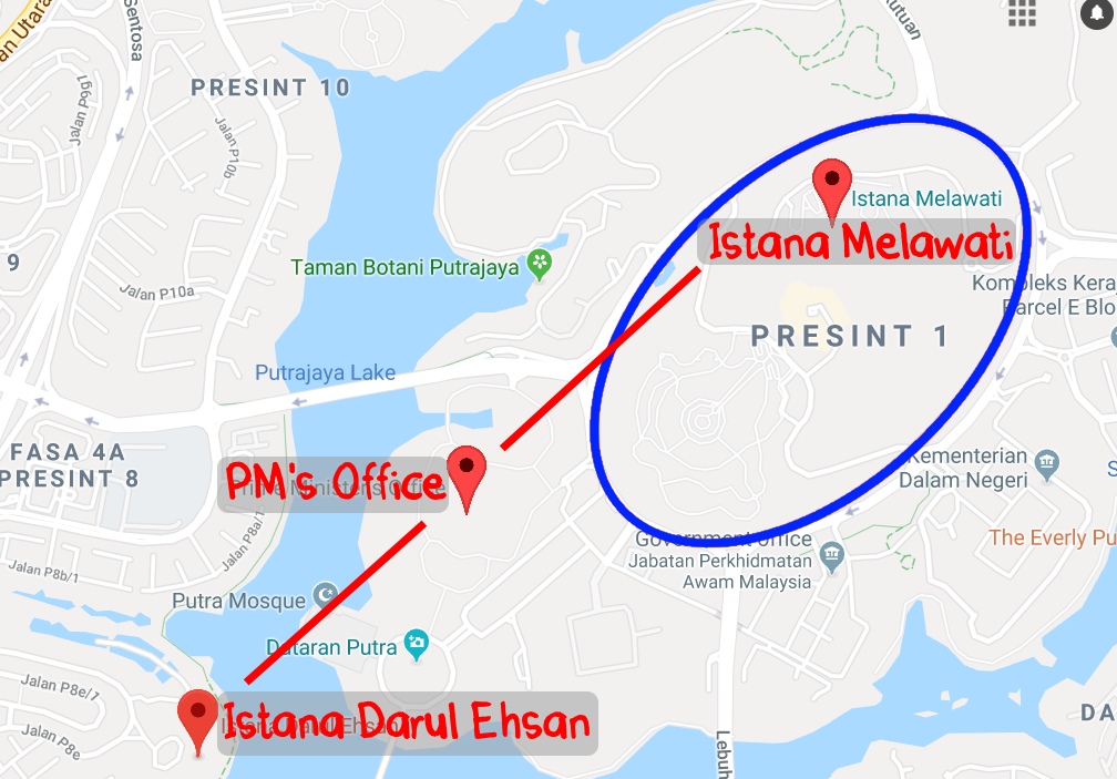
They ended up choosing Perang Besar because of the new highway and airport connection (construction on KLIA started in ’92). Also, the Perang Besar site was under one estate, making acquiring the land easier (and cheaper). And third, because the North-South corridor provided an opportunity for expansion (the Klang valley urban expansion was East-West, think KL-PJ-Subang-Shah Alam-Klang). If this all sounds a bit confusing, have no fear, we have a handy map for yous!
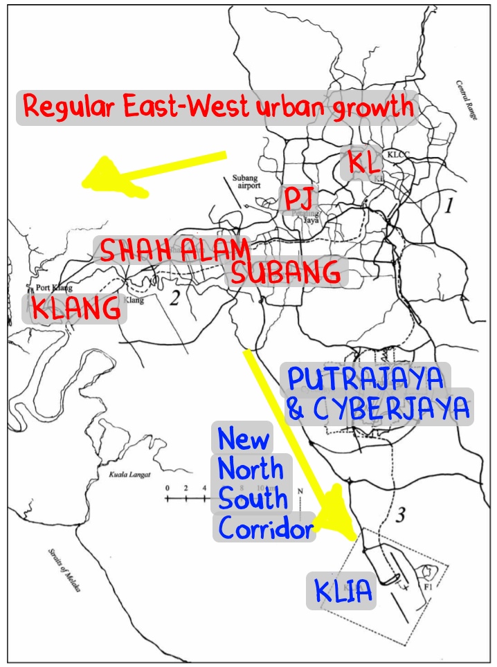
The proposals planned for around 300k inhabitants in Putrajaya by 2006, with a total population of 570k including the surrounding housing areas. The population of Putrajaya today is… *drumroll please*… 90k. Just a little bit short of the original goal (So yeah, Malaysia is NOT overpopulated k. Still got plenty of space). That said, there are some very important people living there!
3. Putrajaya has not one, but TWO palaces (no we’re not talking about the PMs house)
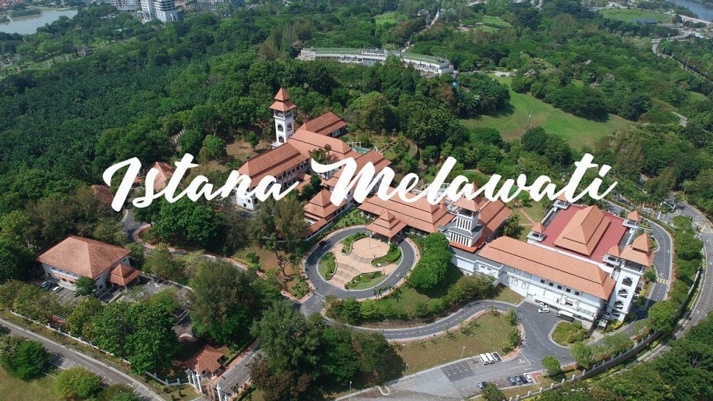
We all know the Prime Minister’s office and residence is in Putrajaya, but the Yang di-Pertuan Agong also has a SECOND palace in Putrajaya, on top of his majesty’s old-new Istana Negara in Segambut, KL that we all know and love. Yes, the Putrajaya one is CONFIRM the secondary one, since its actual name is… the Istana Melawati (literally translated as the ‘visiting palace’ for when the king visits).
But wait, there’s more! The Sultan of Selangor ALSO has a palace in Putrajaya! The Istana Darul Ehsan was built by the federal government for the Sultan of Selangor (as thanks for giving them the land). Just like the Yang di-Pertuan Agong, the Sultan of Selangor’s Putrajaya palace is also his second, with his primary palace being the Istana Alam Shah in Klang (And not Shah Alam as the name might suggest).
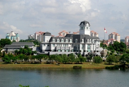
Now here’s the thing, remember when we talked about how everything in Putrajaya was planned? On a map, these two palaces surround one building – the PM’s office. In fact, the Istana Melawati was also built to be slightly higher up than the PM’s office… heh.
4. Putrajaya was built for cars, and it shows
Okay, this one might be kinda obvious for the 12 of you who’ve actually been to Putrajaya. But did you know that Putrajaya Holdings, the developer of Putrajaya, was largely funded by Petronas who paid up RM800 million of the initial RM2.2 billion capital? As a result, a lot of the infrastructure is built around cars including EIGHT fancy car bridges and, allegedly, the world’s largest roundabout.
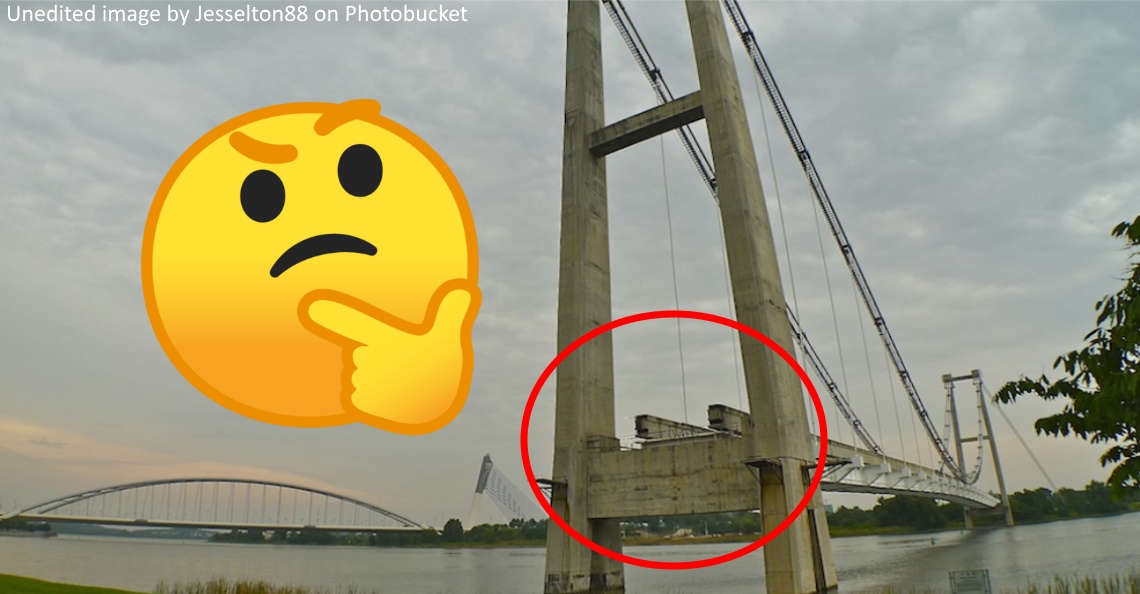
Thing is, it didn’t have to be this way. There were plans to include a LRT system in Putrajaya, but they were changed to a Monorail due to budget concerns. Rails, tunnels and a bridge were built for the new monorail line, but these were also abandoned in 2004.
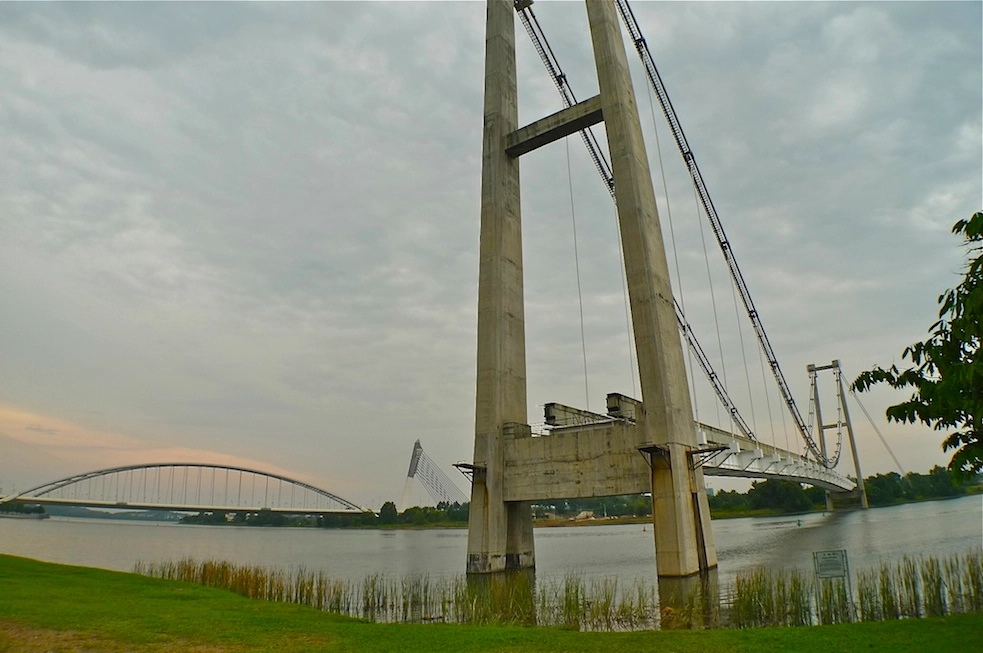
“The world’s only suspended suspension bridge” – Tun Dr Mahathir Mohamad.
We seldom come across abridged jokes, so well played Tun M! In 2015, an extension of the MRT line into Putrajaya was approved, which will finally connect Putrajaya to the greater Klang valley transportation lines. More recently, the gomen has been holding feasibility studies to potentially revive the monorail project too.
5. In Putrajaya, big means BIG
Roundabouts and construction delays are not the only things up-sized in Putrajaya. The lake is also supposedly the largest man-made wetland in the tropics, which helps cool the temperature in Putrajaya abit. Photos taken around the lake also become very cool.
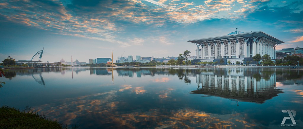
To top that off, for you rock climbers out there, the Putrajaya Challenge Park is also home to South East Asia’s largest indoor climbing gym. And at RM6 per entry (RM3 for students!), it’s really worth a trip all on its own. All of this contributes to the sense of scale of the place. Compared to claustrophobic KL, everything in Putrajaya just feels vast and big. In 1999, a New York Times reporter referred to the buildings as ‘Brobdingnagian’, a reference to the giants in the novel ‘Gulliver’s Travels’. That being said, not everyone is a fan of the grandeur and scale.
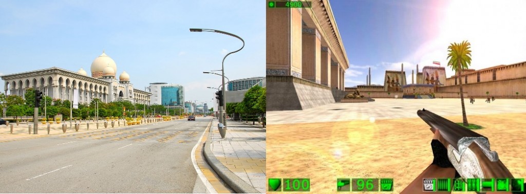
In addition to that, Lim Kit Siang, the leader of the opposition at the time, had this to say about the PM’s office in Putrajaya:
“‘It’s bigger than the White House and 10 Downing Street put together. Even without a recession, you couldn’t justify a thing like this. It’s on too colossal a scale.” – Lim Kit Siang, July 1999, The New York Times.
As it turns out, Lim Kit Siang wasn’t the only one complaining about Putrajaya.
See, Mahathir isn’t happy with how Putrajaya has turned out either.
Putrajaya today is primarily the home of bureaucrats and their families. And it bothers the PM that the streets are empty.
“I wanted to build a boulevard like the Champs-Élysées in Paris, with side roads and lots of shops. People would go to and fro walking and having coffee in cafes and all that. But civil servants, they want to be exclusive. They didn’t want anyone there. I told them if you do that then the whole town goes dead and it becomes dangerous.” – Mahathir, in a 2018 interview with the Wall Street Journal.
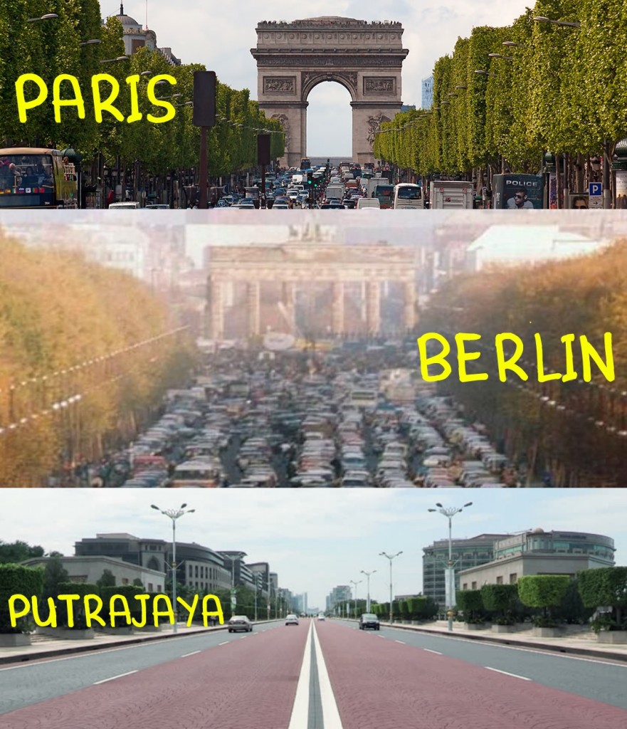
Under Mahathir’s second run, however, Putrajaya has seen quite a bit of resurgence. Changes include a historic Merdeka parade involving the armed forces in Putrajaya, some vague plan to make Putrajaya an eSports city (umm, okay??), making the city car-free for a day (actually worked surprisingly well!) and many other projects.
With all the buzz and hype around it now, Putrajaya might actually become a popular scenic lepak option for the new generation. After all, have you seen the Instagram photos coming out of Putrajaya?
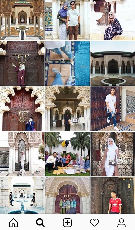
So yeah, next time a public holiday comes around, and you’re looking for a lepak-selfie-TinderDateIdea spot, maybe consider showing our national capital some love? For one thing, there’s less people around 😉 and for another, look how amazing the city looks.
Oh and for all our friends working in the Federal Territories, Happy FT Day!
PS: If you’d like more stories like this, please subscribe to our HARI INI DALAM SEJARAH Facebook group 🙂
- 1.3KShares
- Facebook1.2K
- Twitter13
- LinkedIn22
- Email15
- WhatsApp49
