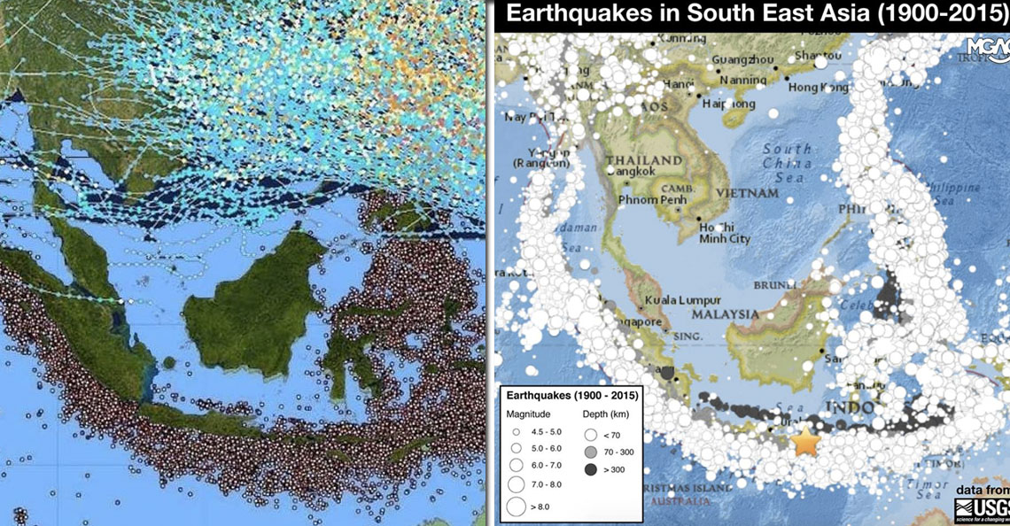
What did Malaysia look like 700 million years ago? We got some images…
- 603Shares
- Facebook574
- Twitter4
- LinkedIn4
- Email6
- WhatsApp15
It’s 2021! And while we may no longer be expecting this…
…to happen anytime soon, there is definitely one thing that you may wanna look forward to this year and that is…
✨ Time traveling ✨
Ok, we know what you’re thinking. While it sounds a bit too good to be true, allow us to ensure you that we’re not tryna scam you here pull your leg. That’s because we recently found a website called the Ancient Earth Globe that allows you to virtually travel back in time.
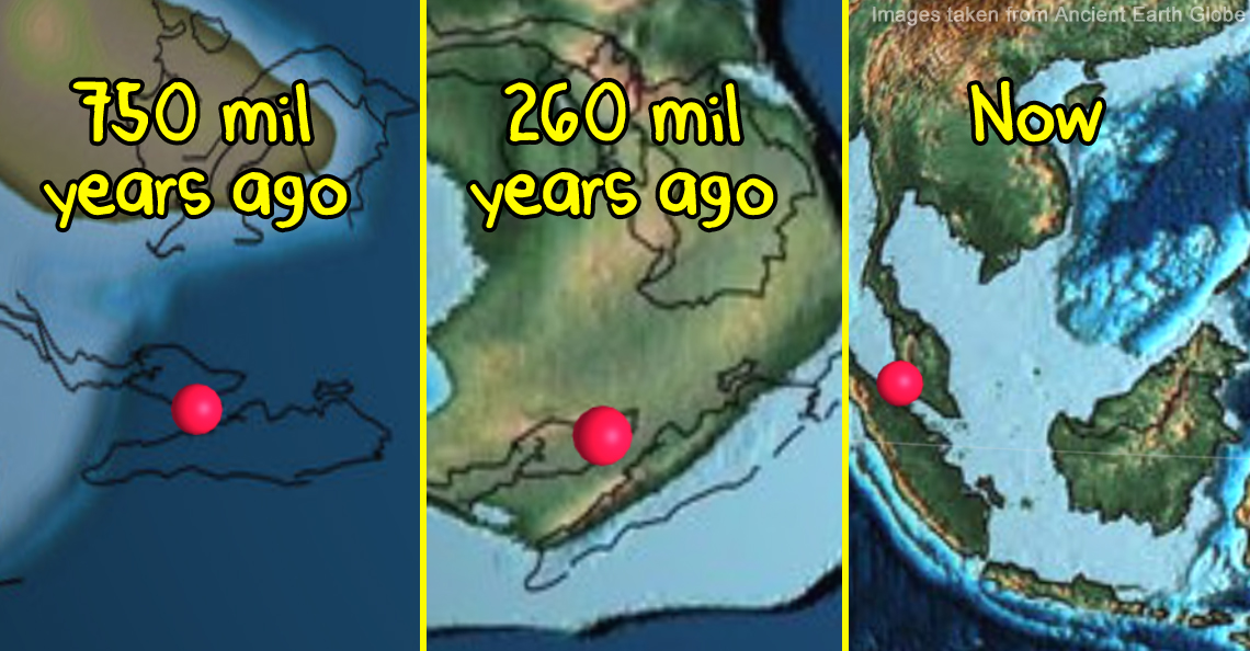
And when we say traveling back in time, we’re not talking about a decade or centuries ago but MILLIONS of years back. So, hop on and let’s travel in time to see how Malaysia actually looked like millions of years ago.

Ok, just a quick disclaimer: the pictures we’re gonna show are obviously not Malaysia as a nation, but the land mass that eventually became the nation of Malaysia, geddit?
Anyways, using Kuala Lumpur as the location (cos for some reason it won’t detect Malaysia in general) and indicators written on the website’s tutorials (which we’ll get to in a bit), let’s start with…
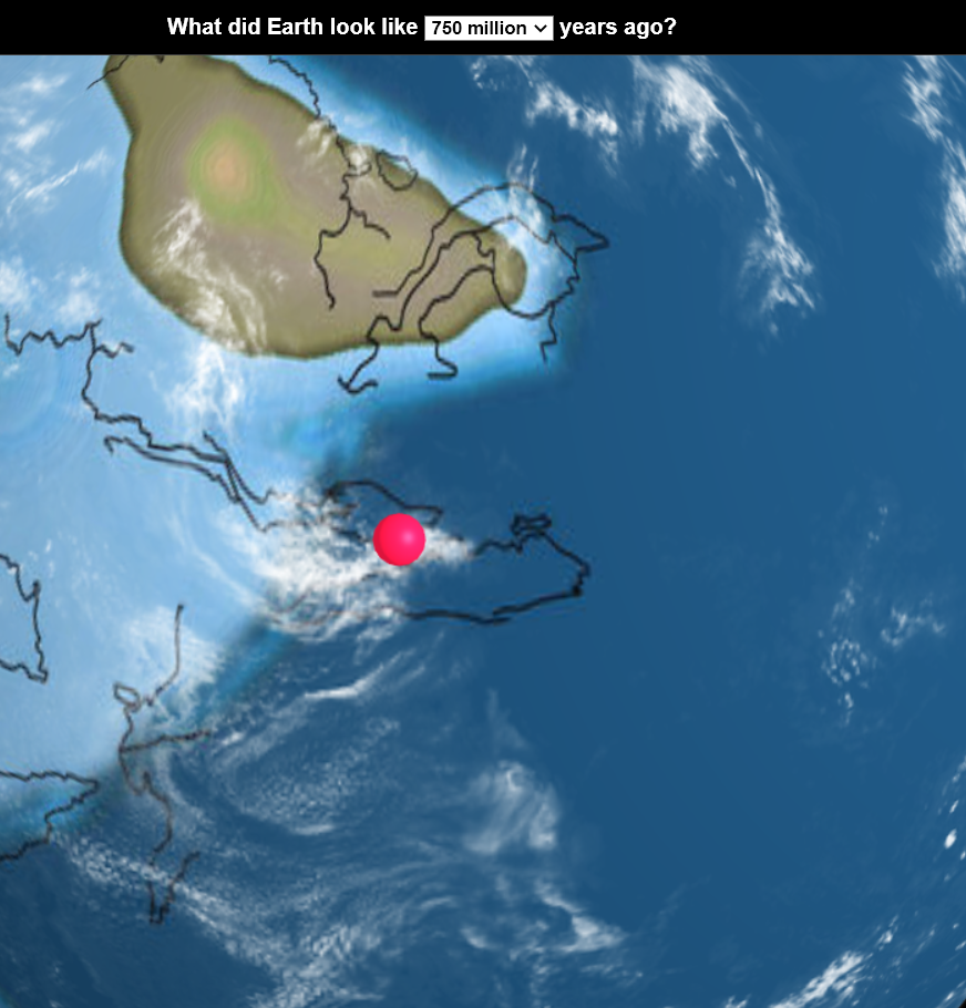
1. 750 million years ago, Malaysia was just an ocean
2. But 210 million years later, the ocean became shallow
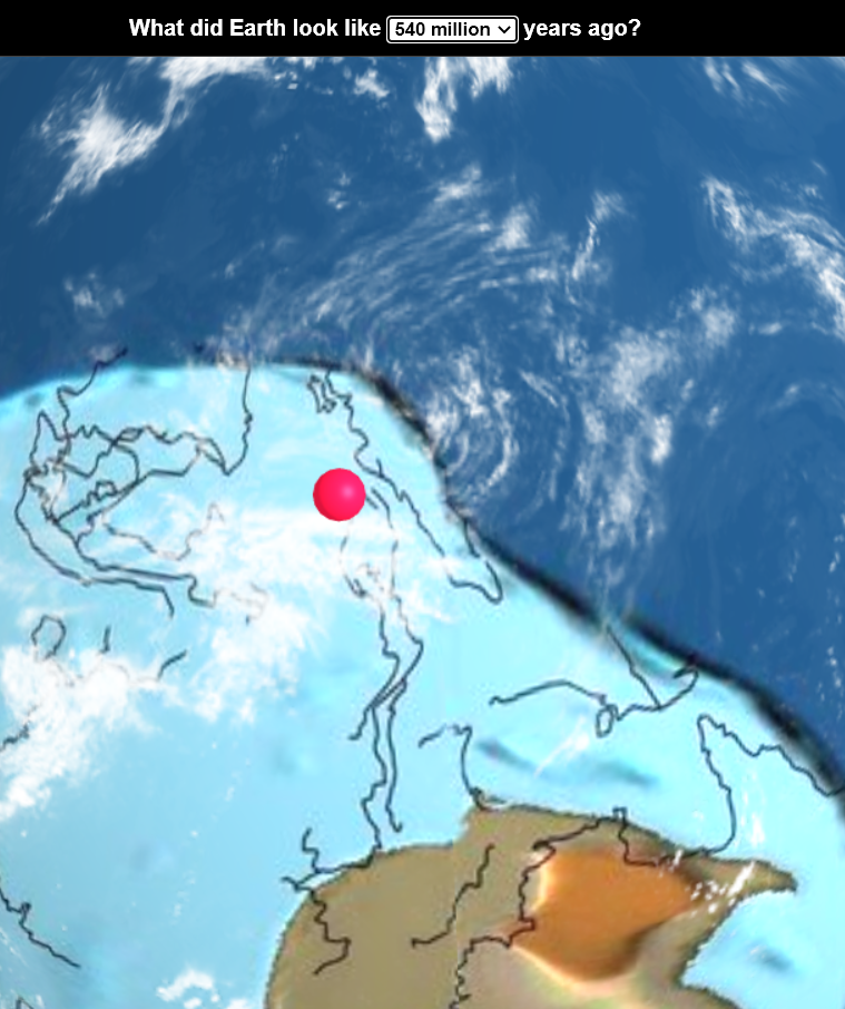
3. Suddenly, Malaysia became an island…
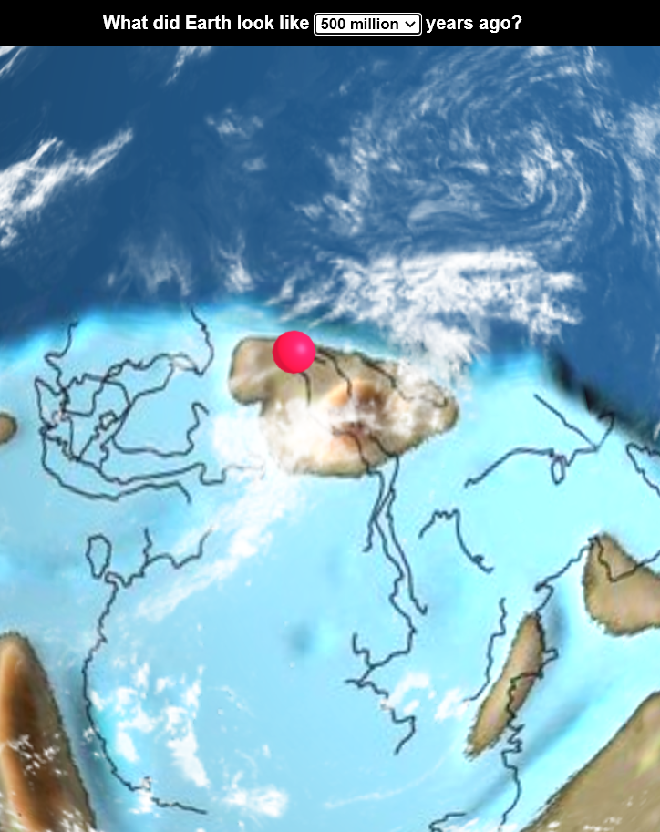
4. …but not for long
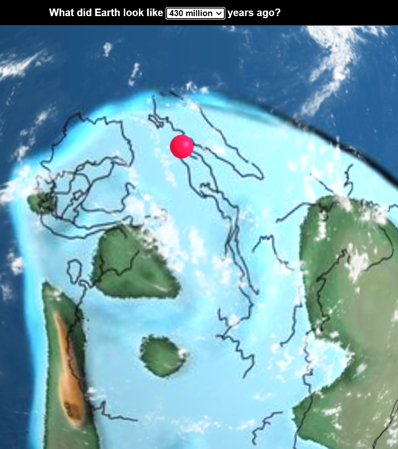
5. 150 million years ago, Sabah already had traces of mountains(!)
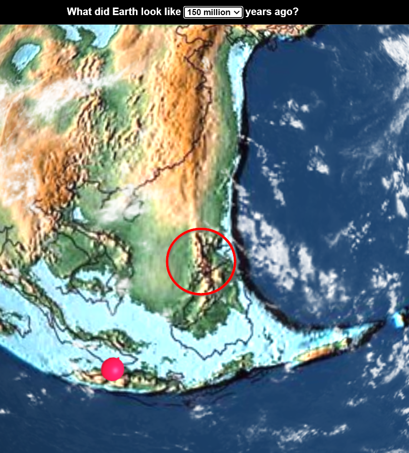
6. There was once when the Malaysian map looked like the ones we know today 👀
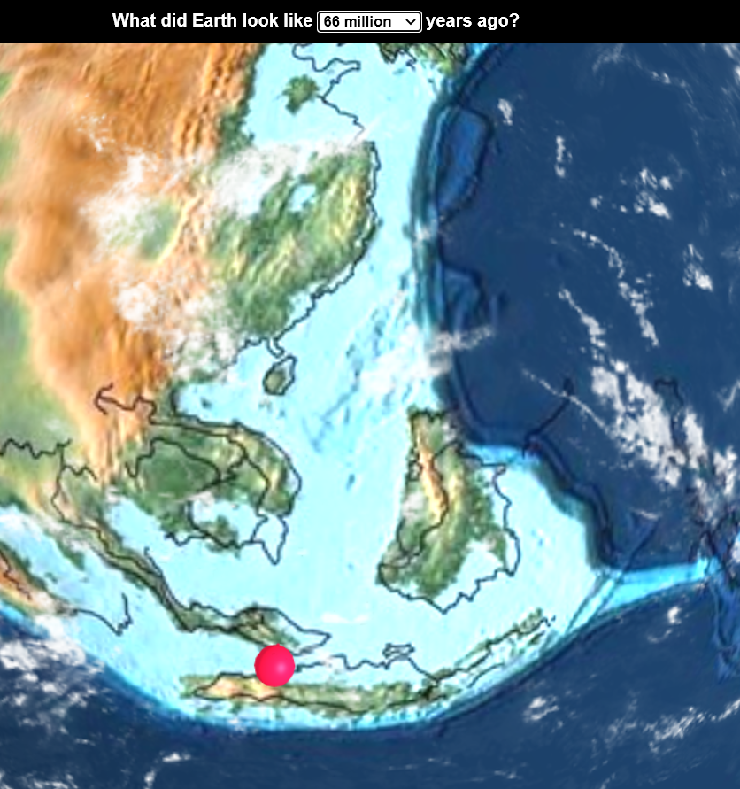
7. 20 million years ago, Malaysia was lumped together with Indonesia and Thailand in a huge island
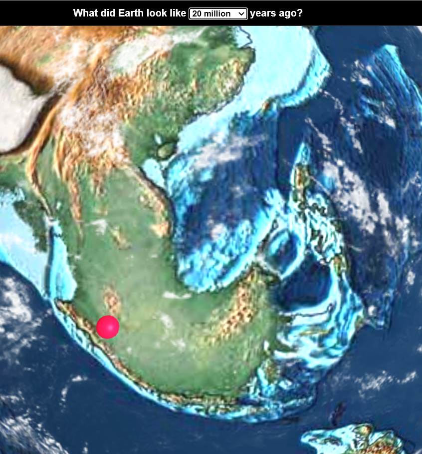
8. Last but not least, the map of the present day…
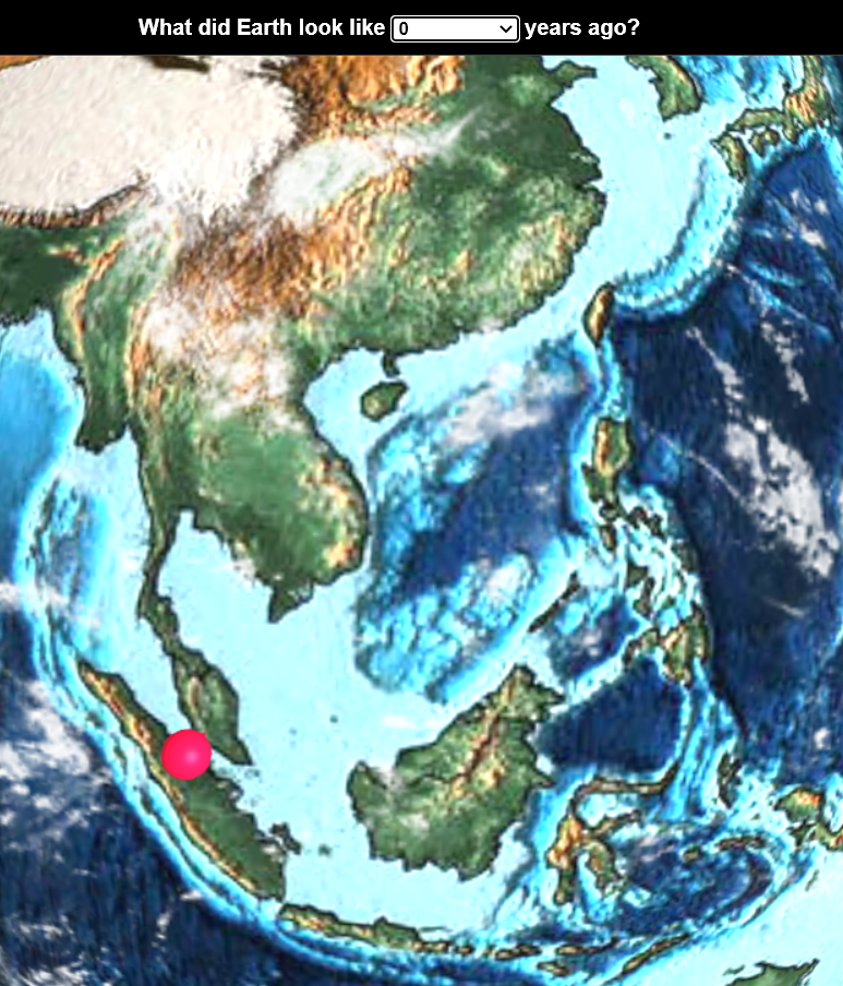
While this has been a fun journey so far (we do hope it is for you too tho), we’re pretty sure some of y’all are thinking…
Err… CILISOS, what are we actually looking at??
If you’ve looked through those pictures above and wonder wadaheck are you looking at, well that’s something called the Tectonic Plates. We’ve explained this before but let’s just refresh, ok?
Now, just imagine tectonic plates as puzzle pieces cos they kinda look those anyways:
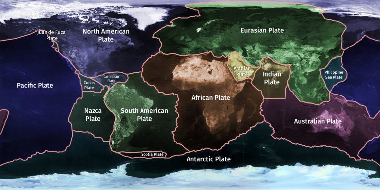
But unlike those puzzle pieces that you frame on your bedroom wall, these pieces MOVE a centimetre a year due to heat. This may be why, if you were to go through each and every stage of years on the Ancient Earth Globe, you’d notice how these tectonic plates moved.
We contacted the person behind the website, Christopher Scotese (whom we’ll introduce formally in a bit) to confirm whether this is also the reason why islands kept on appearing and disappearing on where Malaysia is located. However, he told us that islands kept appearing and disappearing because the Sunda sea is really shallow. You’ll see land when the sea level drops by more than 50 metres!
He also explained the reason why Malaysia’s map 66 million years ago looked almost the same to the ones we know now.
“I am using modern topography as a base and changing it slightly through time and changing sea level. If sea level was close to modern (present day), then the shapes of the coastline will be similar.” – Christopher to CILISOS in an email interview.
Anyways, how does the creator of the website even know all these?? For a start, the creator of the map is no random person. Meet Christopher Scotese, an American geologist and paleogeographer (not to be confused with a palatao), basically a person who studied geography of the ancient times.

Thanks to his expertise, he managed to recreate a paleogeographic map (a map showing the world geography in ancient times) with information taken from images, complete geographic evidence like minerals (known as geological lithofacies) and historical evidence of an area in case geographical lithofacies aren’t sufficient.
And just like how Rome wasn’t built in a day, this information wasn’t gathered in a day or even ten years. However, unlike building Rome, this information has been gathered by geologists around the world for more than 200 years(!). And with this information, Christopher managed to recreate ancient tectonic features for not one but 91 paleogeographic maps just for this project!
So, when you combine all these geographical information and technology aka a software to visualise tectonic plates that was used for this called Gplates, you’re able to come up with a simulation of how the world looks like waaaayyyyyy back during the dinosaur period or even before that. And that’s what Christopher together with a developer, Ian Webster, achieved through the Ancient Earth Globe.
Well, of course, there are more details to the project then what we mentioned here la. So, for Geography geeks out there, you can read more about the project here, here and here.
Just in case you haven’t noticed, we’ve only listed out 8 interesting things we found from the Ancient Earth Globe. There are actually more things you can discover on the website itself. But before you head on there, here’s a quick guide on what you’ll be looking at:

There are also additional explanations on what happened during years, so time travelers, watchu waiting for? Get your DeLoreans running and head here to discover more. Oh, and if you love dinosaurs, you can also read through the various species here.
- 603Shares
- Facebook574
- Twitter4
- LinkedIn4
- Email6
- WhatsApp15

