Malaysia asyik kena haze, but this time the culprit is not Indonesia. It’s geography
- 91Shares
- Facebook74
- Twitter4
- LinkedIn4
- Email4
- WhatsApp5
If you’ve been feeling a lil hot under the collar lately, it’s probably cos Malaysia’s been hit by a bout of bad weather. Yep, our arch nemesis ye olde haze is back.

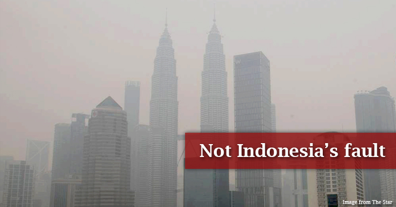
So far it seems like Penang is the worst hit, with visibility on the island practically non-existent. Most of the northern states also have it pretty bad and KL isn’t that far behind. Just look at this massive blanket of smoke covering the city.
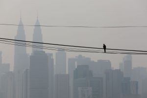
The biggest irony here is that we always hear about Malaysia’s ✨unique geographical location✨ protecting us from all sorts of natural disasters but in return, every year we kena haze, aduh… And to add salt to the wound, our sources are also expanding. So if you were about to hentam Indonesia for their reckless fires, hold up kay, cos surpriseeee, it wasn’t them!
The real culprit this time is the Mekong sub-region, an area consisting of Laos, Myanmar and Thailand to name a few. Wahhh, not enough that we get haze from our friend below but now it’s coming from countries up north too?? Cry. And that place summore so far away! Like Laos is actually bordering China, how on earth did haze from there reach all the way down here?
Malaysia’s unique geographical position will suck in all the wind & haze
So here’s where we stand right now– because the Mekong subregion is literally under fire, the Asean Specialised Meteorological Centre (ASMC) has raised a Level 3 alert, which means there’s a high risk of transboundary haze, which means that haze be travelling far AF. And that’s exactly what we’re seeing now, or not seeing, technically, cos haze, ha… ha.
The centre also said that due to persistent winds, the haze ain’t going nowhere for the time being.
“The current dry conditions are expected to persist in the coming days, with the prevailing winds forecast to blow from the northeast,” — ASMC
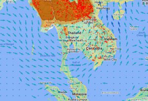
The picture below shows how the wind has been moving lately. You can see that it’s sweeping over hotspot areas and sending it directly to Malaysia’s northern states.
Now remember that little joke in the beginning about our ✨unique geographical location✨? Well, bad news guys, cos it might actually be the reason why we’re always getting haze from our neighbours.
So Malaysia’s situated near the equator, right? The significance of this is that sunlight hits the equator directly and it’s super hot. Now the hot air is gonna rise, and as it rises, it’s gonna spread out to cooler areas. But doing so creates a sort of empty space, like a giant vacuum sucking in air, so winds will always rush towards the equator. In short, Malaysia’s location sucks, cos we’re pretty much a magnet for haze no matter where it comes from 😭

Still tho, we did mention how far Laos and Myanmar are, right? Like how bad are the fires that even after all that travelling the haze is still this heavy? Well, it turns out the ongoing fires are super widespread, and when we say widespread, what we mean is…
Myanmar, Laos and Thailand have all lighted their crops at the same time
The actual name for the act of burning crop fields is slash-and-burn, which admittedly sounds like a sick martial arts move except y’know, an entire country (and likely more) is knocked out 🥴🤕 Malaysians are actually no strangers to this since we also burn stuff to clear lands for oil palm estates, though occasionally, and on a less noxious scale, farmers do it too to get rid of diseased crops so they can start over.
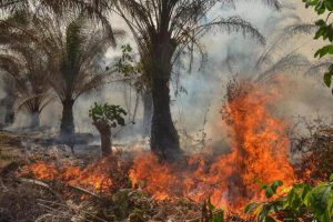
But in Laos, the Hmong people traditionally burned forests to obtain fertilizer. Why, you might ask? Well, wood ash is actually super nutritious for plants and functions the way you would after you’ve had your morning coffee. And this whole thing is still in practice today. So back in February, when the harvest season ended, there was a lot of mass burning. And when in combo with the region’s yearly dry spell (December to May), things really just exacerbated.
Now across the border in Thailand, it’s a pretty similar story with fires spreading from corn. Yeah, wild to think it all comes down to corn, but this is largely because the demand for meat is crazy high and corn is the biggest source of animal feed for poultry. So what happened here was that farmers were burning down forest lands to plant more corn, and as you probably know, forest fires get out of hand really quickly.

And tho there’s less info about the fires in Myanmar, it was reported that the country is also battling multiple hotspots due to seasonal crop burnings. Tbh, the situation in all 3 countries is so bad that leaders of each have actually convened for discussions to try and get it under control.
So yeah, things are pretty damn serious and that’s mostly because all these fires are happening at the same time in countries that are bordering each other. Unfortunately tho, there’s not a lot we can do about it.
We’ll just have to wait it out for better weather
Perhaps the key takeaway here is that you can’t really predict the weather so we’ll just have to wait for some rain and another wind change.

In fact, one of our writers who’s currently visiting his kampung in Kedah tells us that the sky is lookin pretty blue and bright, so fingers crossed the air down south will clear up soon. In the meantime tho, there’s been news of people flocking to hospitals cos of respiratory problems so here’s some advice from a couple of doctors courtesy of The Star:
- If you have asthma or other health issues, keep your inhalers with you.
- Take the flu jab and stay indoors
- Mask up when you head out
- Drink LOTS of water
- Can consider sinus flush aso
And a bit of trivia before we end cos we couldn’t stick it anywhere else, the reason it’s called the Mekong sub-region is because that’s where the Mekong river (3rd longest river in Asia) runs its winding spindly course!
- 91Shares
- Facebook74
- Twitter4
- LinkedIn4
- Email4
- WhatsApp5


