Remember the cold weather in Msia in 2018? We find out if it’ll happen again in 2019

- 1.4KShares
- Facebook1.3K
- Twitter5
- LinkedIn9
- Email11
- WhatsApp27
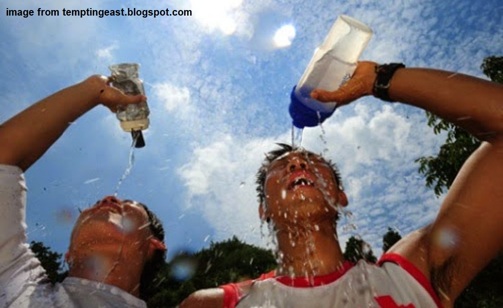
Do y’all remember the “winter” we experienced last January? In case you forgot, Peninsular Malaysia experienced the coldest weather in months, when the temperature went as low as 22 oC. A similar thing happened in January 2014 when the temperatures in many lowland areas went below 25 oC, with the lowest being 17.2 oC in Kuala Krai!
So, last year, pretty sure you guys were shocked at how it was sooo cold after being used to Malaysia being a little hotter, like this guy on social media.
“The weather in Malaysia is actually cold. Let me repeat — THE WEATHER IN MALAYSIA IS ACTUALLY COLD. This literally does not happen all the time living in a tropical climate,” – @mabeses wrote.
Or complaining about having to wear a sweater like this guy.
“I had to wear a jacket, which feels dumb in the tropics.” – @diandujour tweeted.
Maybe some of you would’ve wondered if winter was coming to Malaysia.. But nooooooo… When the cold spell ended a few days after, it was clear that we’re not gonna have the chance to build a snowman in the taman.

Anyway, Malaysian Meteorological Department (MMD) said that, although the cold spell was a temporary phenomenon, it can recur in February this year if the northeast monsoon winds from China blow towards us again. Now that it’s January again, we tried to find out if we should expect a cold spell anytime soon. But first…
It becomes cold because… the sun wants to sleep?
Scientists said that the causes of these cold spells are the “sleeping sun” phenomenon and global climate change. The sleeping sun refers to the drop in activity on the surface of the sun. Furthermore, according to Faizal Parish of the Global Environment Centre in 2014, the scientists have seen lower sunspot activity now compared to the past 10 years.
Scientists in Europe have warned that the lack of sunspot activity could lead to a new mini ice-age there, similar to the one that happened in the 17th century known as the Maunder Minimum. Drastically reduced sunspot activity occurred between 1645 and 1715, which caused London’s River Thames to freeze!
But in Malaysia, lower sunspot activity alone does not cause a drastic drop in temperature. In 2014, the Malaysian Meteorological Department (MMD) dismissed speculation that the drop in temperatures was due to the sleeping sun.
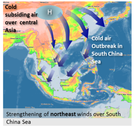
In fact, another reason mentioned by weather experts is the northeasterly winds during the northeast monsoon. The cold mass of air coming from China followed by heavier rainfall lowered the temperatures. Usually when China experiences a dip in temperature, the cold air just stays there but last year, it came south because of a change in the high-altitude wind flows, which Faizal added was due to global climate change.
“The impact of climate change is not just global warming. It can lead to extreme weather, such as heatwaves, cold snaps or droughts. Melting sea ice in the Arctic and changing weather patterns are both possible drivers of the new winter weather trends.” – said Faizal.
On top of that, MMD claimed that January is always the coldest month, based on their records. MMD also claimed that good weather and non-cloudy conditions in Malaysia reduced the temperatures too.
“Atmosphere without clouds is similar to a situation where there is no blanket to keep us warm. The blanket is the cloud and our body is earth.” – MMD said.
Speaking of blankets…
Would you need to wear sweaters in the coming weeks?
MMD hasn’t explicitly confirmed the occurrence of the cold spell but it has made predictions about the amount of rainfall from January to June 2019.
What does this have to do with cold weather? Well, according to a research paper by MMD, most of the cold surges in early 2017 happened at the same time as heavy rainfall episodes. On top of that, according to Decoded Science, we tend to feel cooler during rainy weather for 2 reasons:
- It takes more heat energy to warm water than air, so if the layer of air next to the skin is damp, it takes more of the body’s heat energy to warm it.
- A damp/rainy day is more likely to have a lower level of sun exposure because the clouds are blocking the sun lor.
So, we’ll assume here that heavier rainfall gives lower temperatures.
And so, with that in mind, we decided to analyse rainfall estimates obtained by MMD to predict if we’ll get a cold spell or not, for the first 3 months of 2019. Since MMD’s forecast doc was published in BM and its table was pretty lengthy, we made another table to show some of the info.
By the way, smaller states have one set of values for each month while bigger states have more than one, hence the split of some sets of values into different parts of the states, which have different levels of rainfall. But if you don’t wanna look at it, you can sit back and let us do the analysis for you.
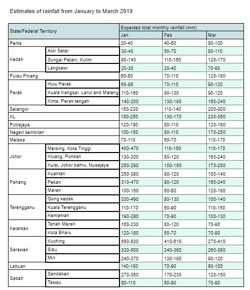
We tried ranking each place with the highest minimum rainfall to the lowest minimum rainfall each month, and noticed some patterns:
- Kuching has the highest rainfall for all 3 months.
- Sibu maintains its rank in the top 3 throughout the 3 months (330, 240, 260) while Miri steps down from 240 to 130 to 90.
- Sandakan and Tawau damn contrast wei. Sandakan has been having a significantly higher rainfall than Tawau. Melaka is pretty low too although it increases in March.
- States in the northeast of Peninsular Malaysia (Kelantan and Terengganu), Pahang and Johor have generally heavier and significant rainfall in January than in February and March.
- Central west areas (Selangor, KL, Putrajaya and Negeri Sembilan) have significant rainfall in January, lower rainfall in February and then much more in March.
- States in the northwest of Peninsular Malaysia (Perlis, Kedah and Penang) generally have the lowest rainfall (20 to 80).

Based on the level of rainfall, how likely are these places gonna experience a cold surge?
- The cold surge is most likely to happen either in January or March.
- Kuching and Sibu are most likely gonna have a cold surge, reducing over time tho.
- Kelantan, Terengganu, Pahang, Johor, Sandakan, Labuan and Miri are very likely to get it in January.
- Selangor, KL, Putrajaya and Negeri Sembilan are very likely to get it in March.
- Tawau and Melaka are not so likely.
- Perlis, Kedah and Penang are least likely.
So, after the headache-inducing analysis of the estimates, the bottom line is: Most of Malaysia is gonna get a cold surge (except Perlis, Kedah and Penang). So everyone in Malaysia, except for those in Northwest Peninsular, are encouraged to sweater-up and carry umbrellas for the next few months, unless you wanna shiver.
Weather forecasting is not as magical as looking into the crystal ball
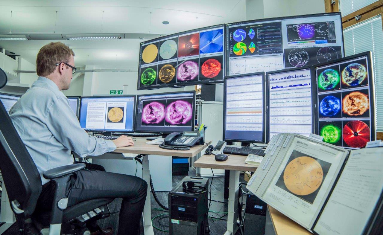
The basis of creating weather forecasts is numerical forecasting, which uses advanced math equations to process tons of observational data obtained and pooled by many weather stations. And to do the math to predict the weather, cannot use the normal computer that we all use everyday ah… Instead, we need supercomputers that can do millions of calculations per second!
Despite getting a lot of help from tech, different weather sources/apps like the Met Office, the MeteoGroup and the Weather Channel give different forecasts. Some of the reasons the forecast results are different are access to different levels of observations, different algorithms and forecast models, different levels of detail and, different levels of dependence on computer models and human meteorologists’ supervision.
“One big difference between apps is what information they choose to show. Some choose to simplify things while others put in a lot detail.” – said Derrick Ryall of the Met Office.
And it turns out that another source of difference is that accuracy is not what the weather forecasters are aiming for. What?! In fact, American statistician Nate Silver pointed out that many weather forecasters have the tendency to over-estimate rainy weather since peeps would be better off carrying umbrellas whether they use it or not, than to get wet in the rain because no umbrella.
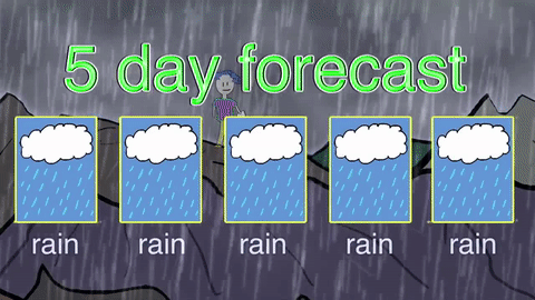
It’s also been proven that a forecast done for the next day is more reliable than a forecast for 5 or 10 days later, mainly because we’d never know if something unexpected happens suddenly, especially in longer periods in advance.
And the challenge in predicting something beyond our control remains, so there’s no such thing as a perfect weather forecast, because to do that, you’d need to model every single particle in the atmosphere and all interactions between them which is impossible, unless you ask Raven Baxter for help.

For an example of how hard it is to be a weather man, back home in 2017, Penang wanted to break away from depending on MMD’s weather alert system and open its own (maybe because of some failures in giving timely weather alerts), which we wrote about in a past article, including a discussion on why MMD has difficulty in getting forecast right. But, of course, knowing how unpredictable the weather can be, how can we expect anyone MMD or any global weather agency to get it 100% correct?
But, at least, forecasting is better now with more advanced techy tools than it was in the 19th century. That time, before computers, they had to draw weather charts on paper based on past observations you know… Now, got SUPERcomputer!
And while it’s not guaranteed that a cold surge is gonna happen again, perhaps we can make the poncho our constant companion. And if you guys have better forecasts than we do, or know anyone who’s born with the best fortune-telling abilities, let us know in the comments tomorrow’s winning lottery numbers. Thanks. 😉
- 1.4KShares
- Facebook1.3K
- Twitter5
- LinkedIn9
- Email11
- WhatsApp27